1901743 1902216 1902263 1902651 2902804 2902807 2902809 2902819 2903432 2903453 2903854 3902363 4903190 4903191 4903196 4903199 5902451 5902467 5902477 5902487 5904624 5904628 5904631 5904641 5904796 5905214 5905227 5905249 5905356 5905400 5905417 5905446 5905457 5905489 5905491 5905492 5905493 5905494 5905502 5905516 5905521 5905546 5905563 5905643 5905646 5905651 5905683 5905708 5905721 5905724 5905735 5905737 5905773 5905881 5905882 5906014 5906064 5906091 5906111 5906144 5906145 5906166 5906169 5906235 5906238 5906260 5906266 5906272 5906287 5906370 5906373 5906394 5906414 5906428 5906462 5906508 5906509 5906569 5906620 5906621 5906622 5906627 5906665 5906667 5906668 5906731 5906745 5906748 5906776 5906778 5906891 5906892 5906903 5906916 5906924 5906928 5906929 6902856 7900828 7900834 7900838 7900906 7900920 7900942 7901102 7901108

Argo profiles in the Australian region

Temperature and salinity down to 2000m

[PREV] [NEXT] [DATE INDEX] [What's shown]
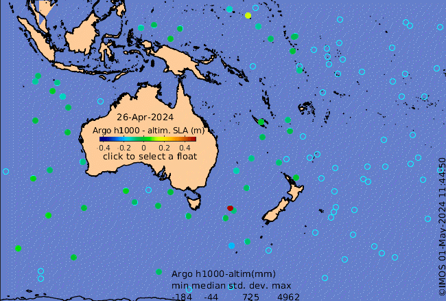
Click on the map below or choose a [WMO number] to see the temperature and salinity data from the selected float compared with satellite-adjusted climatology.

Depending on your settings, your browser may or may not open these links in a separate window.
If nothing seems to open, try right-click/open-in-new-window